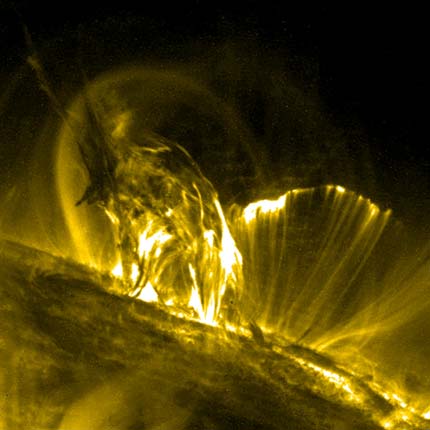
Magnetic lines:
This is the surface of the Sun. The Sun has a strong magnetic field. The magnetic lines of force shape these loops of glowing gas on the Sun's surface. NASA's TRACE spacecraft made this image. Image Credit: NASA's TRACE spacecraft
Slyder Images
Magnetic lines:
This is the surface of the Sun. The Sun has a strong magnetic field. The magnetic lines of force shape these loops of glowing gas on the Sun's surface. NASA's TRACE spacecraft made this image. Image Credit: NASA's TRACE spacecraft
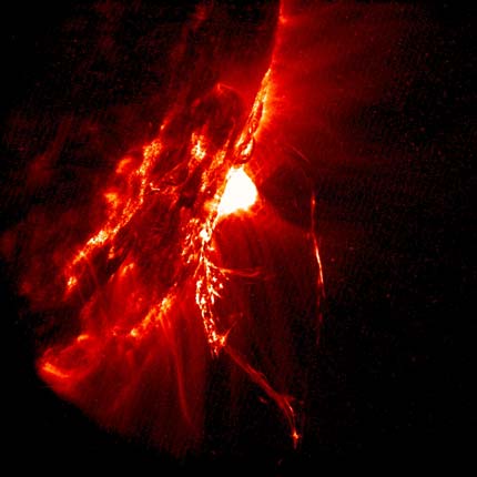
Hot loopy gases:
This is the surface of the Sun. At this spot, strong magnetic forces are pushing out glowing hot gases. The Sun's magnetic lines of force shape the gas into loops. NASA's TRACE spacecraft made this image.
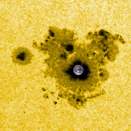
Tiny blue Earth:
This is Earth compared to the size of a sunspot. A sunspot is an area on the Sun with particularly strong magnetic forces. NASA's TRACE spacecraft made the Sun image. Apollo 17 astronauts took the picture of Earth. Image credit: NASA's TRACE spacecraft. Earth image—Apollo 17 astronauts
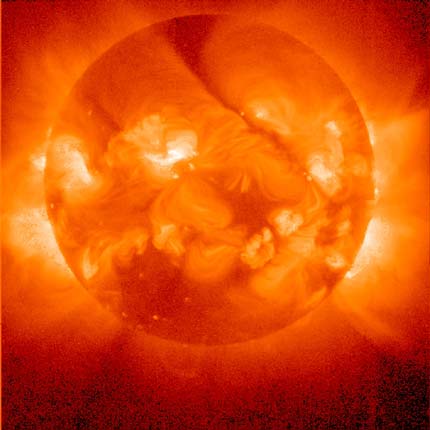
The X-ray Sun:
This is how the Sun looks in X-rays. It shows the Sun's hot, outer atmosphere. We cannot see X-rays with our eyes or ordinary telescopes. A special telescope on the Japanese Yohkoh satellite took this picture.
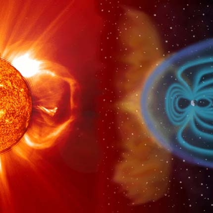
Sun screen:
Earth's magnetic field protects us from the Sun's harsh solar wind and radiation. Without the magnetic field, we would be toast. The SOHO spacecraft made the Sun image. Artist Steele Hill added the rest.
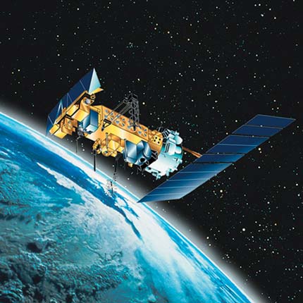
Weather watcher:
The GOES (Geostationary Operational Environmental Satellite) orbits above Earth's equator. It goes around once per day, exactly in sync with Earth's rotation. GOES watches storms develop to help forecasters do their jobs. Image Credit: NOAA (National Oceanic and Atmospheric Administration).
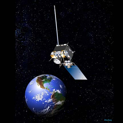
Climate watcher:
The POES (Polar-orbiting Operational Environmental Satellite) orbits Earth near the North and South Poles. It gathers data to help us understand Earth's climate and how fast it is changing. Image Credit: NOAA (National Oceanic and Atmospheric Administration).
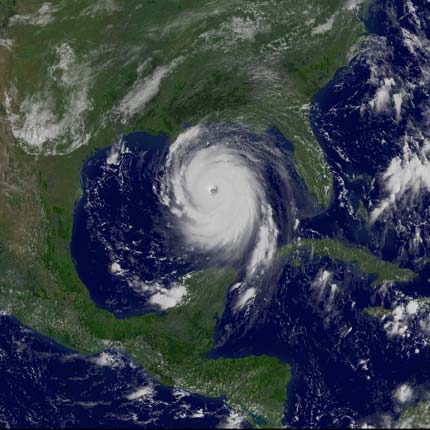
Killer Katrina:
Hurricane Katrina struck the U.S. coastline in the Gulf of Mexico August 29, 2005. It caused terrible death and destruction in New Orleans and other cities. The GOES satellite made this image. Image Credit: GOES (Geostationary Operational Environmental Satellite).
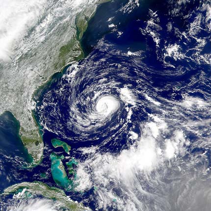
Colorful Atlantic:
Earth-orbiting SeaWiFS (Sea-viewing Wide field-of-view Sensor) captured tropical storm Florence in September 2006. SeaWiFS studies ocean color, which gives clues about tiny plants and animals living in the ocean. Image Credit: SeaWiFS (Sea-viewing Wide field-of-view Sensor).
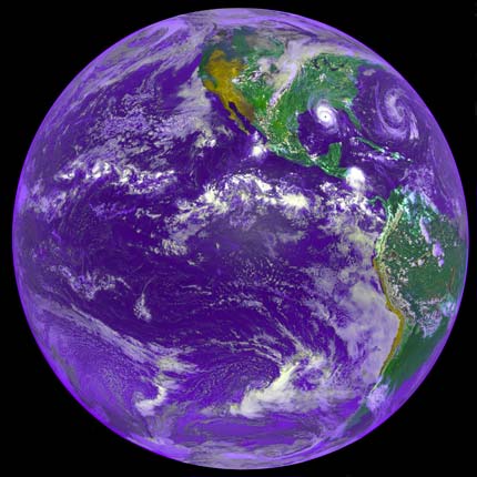
Our beautiful Earth:
This 1992 image of Earth was made by a satellite that orbits 22,500 miles above the equator. Can you find Hurricane Andrew? It is in the Gulf of Mexico, about to hit the Louisiana coast. Image Credit: NOAA GOES-7. Credit: F.Hasler, M.Jentoft-Nilsen, H.Pierce, K.Palaniappan and M.Manyin. Original source: DIGITAL.
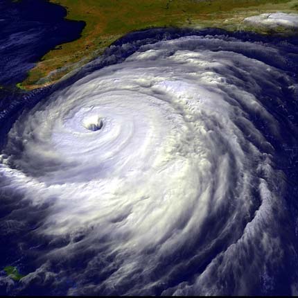
Floyd in 3-D:
This is a GOES weather satellite image. It shows Hurricane Floyd as it hit the U.S. East Coast in September 1999. A computer processed the image data to show the clouds in 3-D. Image Credit: NASA, Goddard Space Flight Center, data from NOAA GOES.
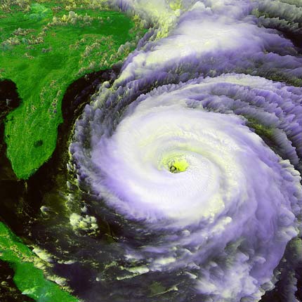
Fran in 3-D:
This is a GOES weather satellite image. It shows Hurricane Fran, near the southern coast of North Carolina in September 1996. A computer processed the image data to show the clouds in 3-D. Image Credit: NASA, Goddard Space Flight Center, data from NOAA GOES.
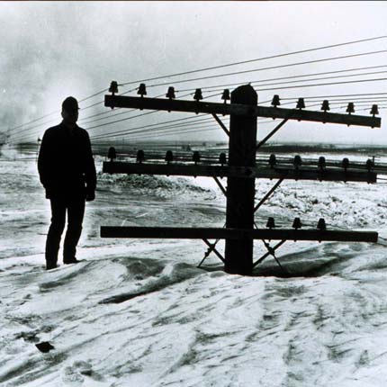
"I believe there is a train under here somewhere!"
A March 1966 blizzard nearly buried utility poles in North Dakota. This is a lot of snow! Image Credit: NOAA Photo Library, Photographer: Mr. Bill Koch, North Dakota State Highway Dept. From the collection of Dr. Herbert Kroehl, NGDC.
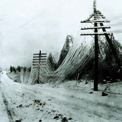
Heavy load:
Heavy ice and snow make a mess of roads. Ice and snow can also damage power and telephone lines, bringing service to a halt. Is this picture in color or black and white? Image Credit: NOAA Photo Library, NOAA's National Weather Service (NWS) Collection.
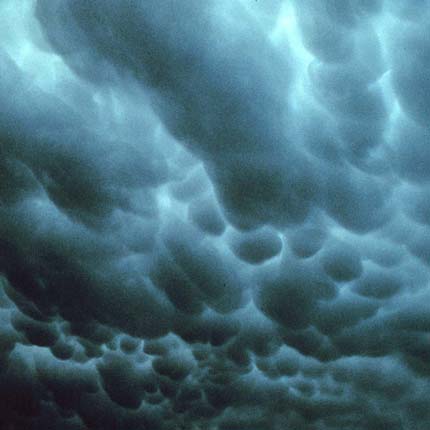
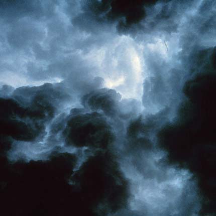
Ready for a downpour:
These dark, scary-looking clouds are called mammatus clouds. These are pouch-like clouds that hang down under the bottom of a cumulonimbus or other type of storm cloud. Image Credit: NOAA Photo Library,OAA Photo Library, NOAA Central Library; OAR/ERL/National Severe Storms Laboratory (NSSL).
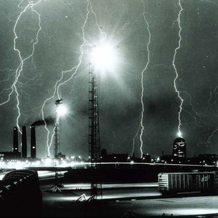
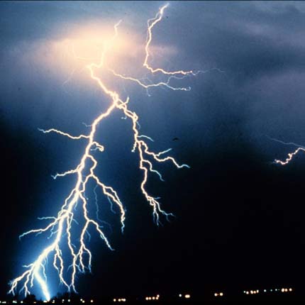
Zap!
This lightning storm over Boston, Massachusetts, really lit up the town! Lightning can happen within a cloud, between clouds, or from a cloud to the ground. Lightning heats the air near it to hotter than the surface of the Sun! Image Credit: NOAA Photo Library, National Weather Service (NWS) Collection, Photographer: Boston globe.
Helter-skelter:
These turbulent clouds rolled in over Norman, Oklahoma. Winds inside and around the clouds are blowing in every direction, really mixing things up. Imagine the bumpy ride if you flew through these clouds in a plane! Image Credit: NOAA Photo Library, NOAA Central Library; OAR/ERL/National Severe Storms Laboratory (NSSL).
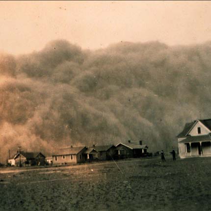
Dust Bowl:
A dust storm invaded Stratford, Texas, on April 18, 1935. Poor farming methods and drought brought on terrible soil erosion and dust storms like this in the 1930s. Image Credit: NOAA Photo Library, National Weather Service (NWS) Collection, George E. Marsh Album.
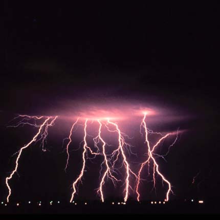
Bolt collection:
This photo captures several lightning bolts that occurred over several seconds during a thunderstorm. Lightning is electricity, and it travels between cloud and ground at around 60,000 miles per second! Image Credit: NOAA Photo Library, OAA Photo Library; OAR/ERL/National Severe Storms Laboratory (NSSL).
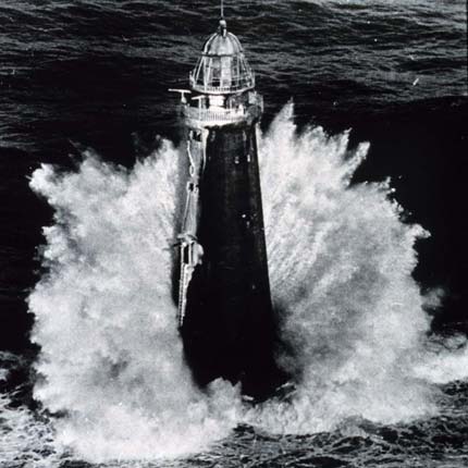
SOS!
It would be scary to be a lighthouse keeper in weather like this. But this is when the lighthouse keeper's job is most important. The light will help ships avoid crashing into the rocks. Image Credit: NOAA Photo Library, National Weather Service (NWS) Collection, Mariners Weather Log.
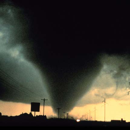
Take cover!
A dark, scary-looking tornado threatens Dimmitt, Texas, in June 1995. If you ever see a funnel cloud like this, head for the basement or cellar. You never know just where the tornado's path will take it. Image Credit: NOAA Photo Library, NOAA Central Library; OAR/ERL/National Severe Storms Laboratory (NSSL).
Loud air:
In this image, many lightning bolts strike during a night-time thunderstorm. Thunder happens when air heated by the lightning stroke expands, then suddenly cools and contracts again when the lightning stops. Image Credit: NOAA Photo Library , NOAA Central Library; OAR/ERL/National Severe Storms Laboratory (NSSL).
Pattern of nature:
These swirling patterns form when clouds are pushed by the wind, but have to go around an obstacle. The obstacle in this image is a tall mountain on a South Pacific island. The LandSat satellite captured this image. Image Credit: LandSat.
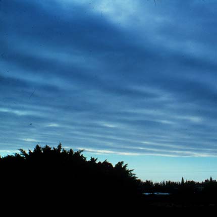
Low ceiling:
These are stratus clouds. They form a flat, thin layer very low in the sky. They don't usually contain enough water to rain or snow. If they are very near to the ground, we call it fog. Image Credit: NOAA Photo Library, National Weather Service (NWS) Collection. Photographer: Ralph F. Kresge.
Puffy and patchy:
These are stratocumulus clouds. They are a little higher than stratus clouds. They have gray or whitish rounded patches. They are often blended together with no spaces between them. Image Credit: NOAA Photo Library, National Weather Service (NWS) Collection. Photographer: Ralph F. Kresge.
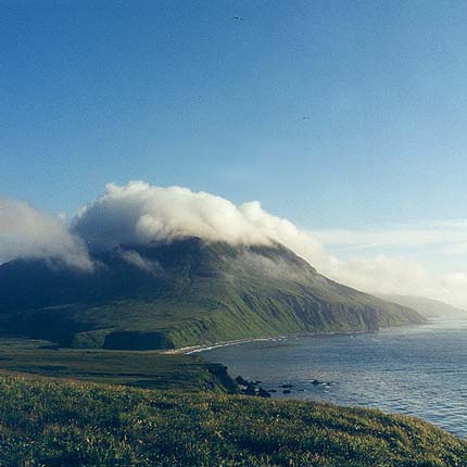
Shaped by a mountain:
This mountain in the Kurile Islands, Russia, molds this low cloud into its own shape. This is called an orographic cloud. Image Credit: NOAA Photo Library, Small World Collection Collection of Dr. Igor Smolyar, NOAA/NODC.
Swirly:
These swirling patterns form when clouds are pushed by the wind, but must go around an obstacle. The obstacle here is Guadalupe Island, off Baja California. The MISR instrument on the Terra satellite captured this image. Image Credit: MISR instrument on the Terra satellite.
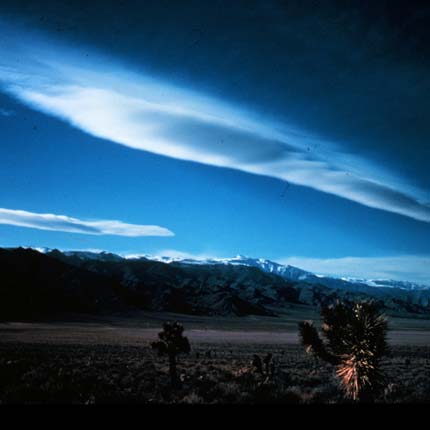
UFO?
These are called lenticular clouds. They are shaped by the effects of mountains. Sometimes lenticular clouds look like flying saucers. These clouds formed over the Inyo Mountains near Bishop, California. Image Credit: NOAA Photo Library, National Weather Service (NWS) Collection. Photographer: Don Carney. Credit: National Park Service.
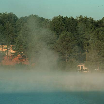
Wake up in a cloud:
Fog forms over this lake in early morning. The water in the lake is warmer than the air. So when the water evaporates, it immediately condenses into fog in the colder air. Image Credit: NOAA Photo Library, National Weather Service (NWS) Collection. Photographer: Ralph F. Kresge.
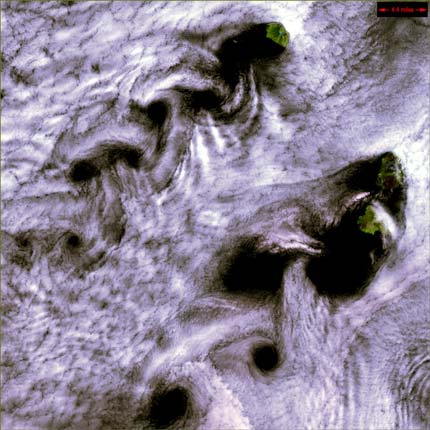
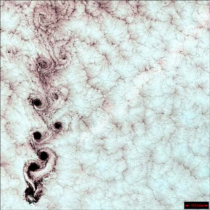
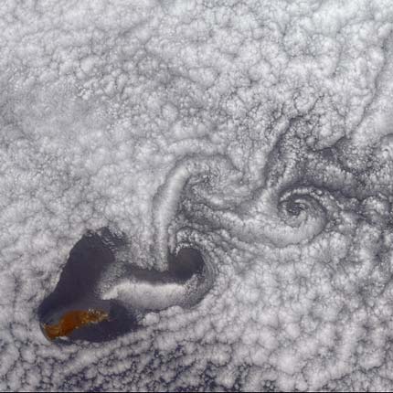
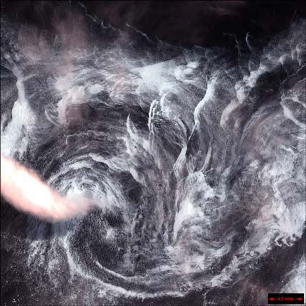
Eddies:
These swirling patterns are called Karman Vortices. They form when clouds are pushed by the wind, but must go around an obstacle. These swirls formed over the Kuril Islands north of Japan. The LandSat satellite captured this image. Image Credit: LandSat.
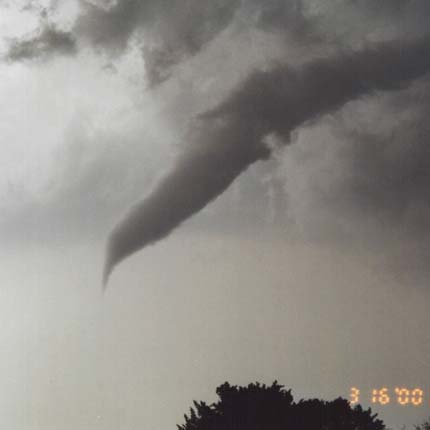
Warning!
If you see a funnel cloud like this in the sky, head for the cellar or basement. It could touch the ground and become a tornado, damaging everything in its path—including you! Image Credit: NOAA Photo Library.
Piled up clouds:
These are called cumulus congestus clouds. They look like tall cauliflowers. They have a sharp outline that makes them look quite solid. They can dump a lot of rain. Image Credit: NOAA Photo Library, National Weather Service (NWS) Collection . Photographer: Cruse/Crowley.
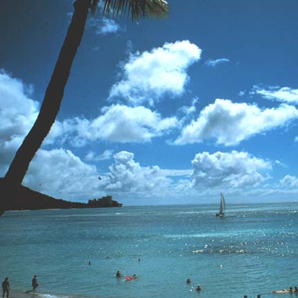
A perfect day:
These fluffy-looking cumulus clouds over Hawaii mean fair weather. This would be a good day for snorkeling, sailing, or just lying on the beach. Image Credit: NOAA Photo Library.
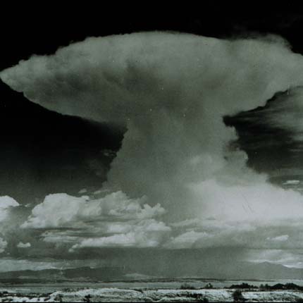
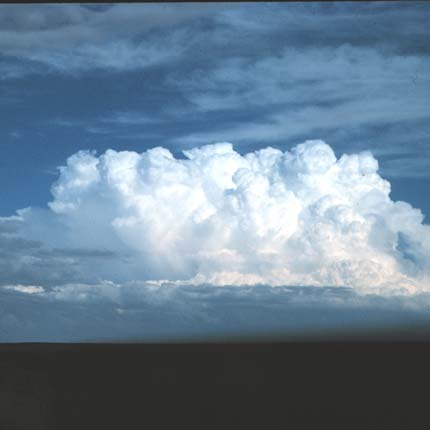
King of clouds:
This is a towering cumulonimbus cloud. It has a top shaped like an anvil. These clouds can climb higher than a jet liner. They are a sure sign of stormy weather. Image Credit: NOAA Photo Library.
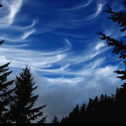
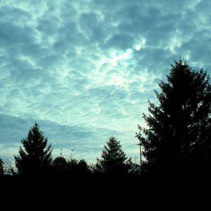
Wispy clouds:
Cirrus clouds look like feathers high in the sky. They are made mostly of ice crystals. In the picture, gray fog is rolling in down where the trees are. Image Credit: NOAA Photo Library, National Weather Service (NWS) Collection, Photographer: Captain Albert E. Theberge Jr., NOAA Corps (ret.).
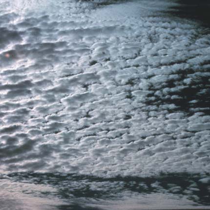
Cottage cheese?
These are called altocumulus clouds. They are white or gray, puffy and patchy with spaces between them. Sometimes they seem to be lined up in rows. Image Credit: NOAA Photo Library, National Weather Service (NWS) Collection. Photographer: Ralph F. Kresge.
Natural colors:
These colorful clouds formed over the Aleutian Islands, near Alaska. Colors may be due to differences in temperature and sizes of water droplets making up the clouds. Image Credit: LandSat.
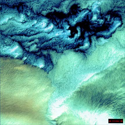
Around we go!
These spinning clouds were seen near Greenland. They are made of ice, clouds, and low-lying fog. Image Credit: LandSat.
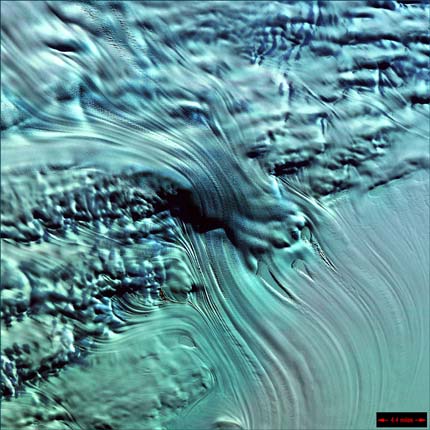
Blue ice:
Here is the frozen Greenland coast. Snow and ice are white, glaciers are blue and gray. The glaciers flow toward the sea, even though they are frozen solid. Image Credit: LandSat.
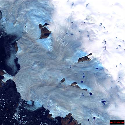
Flowing ice:
This is a LandSat satellite view of Lambert Glacier in Antarctica. It is the world's largest glacier. You can almost see it flowing, even though it is frozen solid. Image Credit: LandSat.